IndiNayan-V1

Overview

Indiflo’s quadcopter redefines aerial performance with its cutting-edge design and advanced capabilities. Crafted from high-strength carbon fiber, it offers unmatched durability while maintaining a lightweight structure for enhanced maneuverability.

Equipped with a powerful  battery, this drone achieves an incredible 65-minutes flight time and covers range of up to 10  kilometers in a single flight. 

Whether for exploration, surveillance, or delivery, Indiflo’s quadcopter combines endurance, precision, and efficiency, making it the ultimate choice for both professionals and enthusiasts. Experience the future of drone technology with Indiflo!

<5 cm

GSD (Ground Sampling Distance)

<10cm

Absolute X & Y Accuracy

1 sq km

@120m AGL

Carbon Fiber Body

Our drone is meticulously crafted from 100% carbon fiber, offering unparalleled strength, lightweight performance, and exceptional durability for superior functionality.

Payload

Equipped with an advanced mapping payload and a state-of-the-art post processed kinematic (“PPK”) module.

Indiflo’s quadcopter is equipped with versatile, high-performance payloads to meet diverse mission needs. Featuring a precision Survey Camera for detailed mapping, a Surveillance Camera with gimbal for stabilized real-time monitoring, a Thermal Camera for heat signature detection in low-visibility conditions, and a cutting-edge Hyper-spectral Camera for advanced data analysis, it delivers unmatched aerial intelligence. Designed for efficiency, accuracy, and adaptability, our drone redefines aerial imaging and surveillance.

Real-World Solutions

DSM
Digital Surface Model
DEM
Digital Elevation Model
orthomosaic
Orthophoto

Quadcopter Specifications

UAV Specifications
UAV Weight with battery and max. payload < 6 kg
UAV Size with Propeller < 1.5m x 1.5m
Endurance (upto 1000m AMSL Take-Off) 60 minutes with Day payload (up to 1000m AMSL Take-Off) 50 minutes with Mapping payload (up to 1000m AMSL Take-Off)
Range of live transmission (LOS) 5 km (un-obstructed & interference free)
Typical Cruise Speed 10 m/s
Propulsion Battery Powered Electric Propulsion
Maximum operating altitude (AGL) 500m AGL (Above Ground Level)
Maximum launch altitude (AMSL) 3000m AMSL (Above Mean Sea Level)
Functional Temperature Range 0°C to +50°C (Self Certified)
Dust & Drizzle Resistance IP53 rating (Self Certified)
Aural Signature <40 Db @300 meters AGL (Self Certified)
Wind Resistance Upto 10m/s (36kmph or ~20knots)
Technical Life of UAV (Landings) Minimum 500 landings (Self Certified)
Launch & Recovery Autonomous Vertical Take-Off & Landing (VTOL)
Maximum space required for recovery 25m x 25m open area
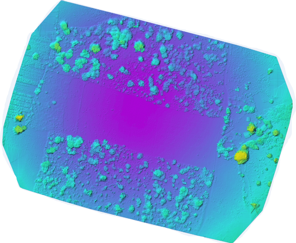
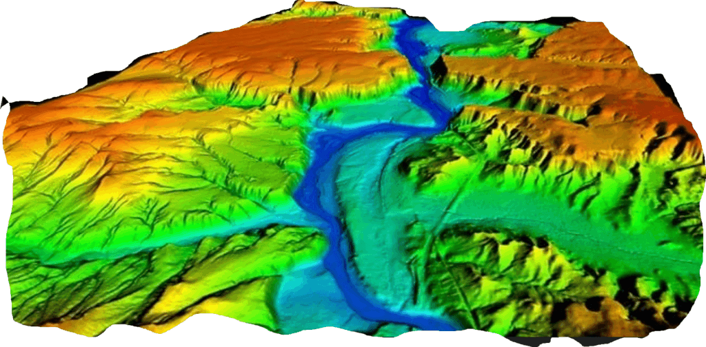
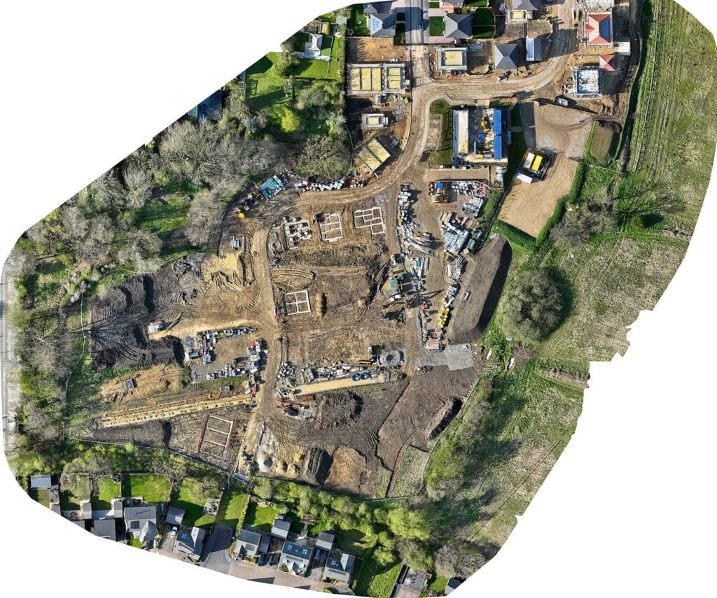
Area Coverage at 120 m (for mapping) Minimum 1.75 sq km at 120 m AGL with 80/60 overlap
Altitude Hold Hover at a defined waypoint Yes
Autonomous Waypoint Navigation Pre-defined as well as dynamically adjustable waypoints during flight
Remotely Piloted mode (RPV Mode) Yes
Real-time Target Tracking of designated static and moving targets Yes

Communication Link Characteristics

UAV Specifications

Communication Link Capabilities

Transmit control commands from gcs to UAV Transmit telemetry data from UAV GCS transmit day and night video from UAV to GCS(Applicable only for surveillance payloads)Secure Communication Link between UAV and GCS with 64-bit AES encryption Digital and Encrypted

Frequency Band

2.4GHz or 5GHz(depending on application

Footer Design